Cherry blossom viewing spots in Daigo Town: Weeping cherry trees, wild cherry trees, and more
- Cherry Blossom Viewing Spot List
- Cherry Blossom VR Tour Map
- Daigo Town Tourist Information (Separate)
- Daigo Town Autumn Foliage Guide (Separate)
List of Famous Cherry Blossom Viewing Spots in Daigo Town
15 Cherry Blossom Viewing Spots
Clicking on the images below will display information for each cherry blossom spot.
Soto-Ono's Weeping Cherry Tree
 【Sotono-Ono, Daigo Town】Cherry Blossom Festival, Light-up, Ibaraki Prefecture Designated Natural Monument
Kutsukake Pass Mountain Cherry Tree Groups
 【Daigo-machi Oose】Daigo Town Designated Natural Monument, Wild Cherry Blossom Cluster, Kutsukake Pass
Mountain Cherry Blossoms at Oku-Kuji Ikoi-no-Mori
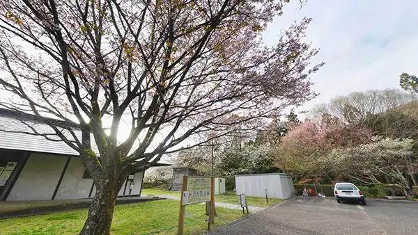
 【Daigo Town, Takashiba】Emperor Showa's Personally Planted Mountain Cherry Tree, Cherry Trees at the Management Office
Oppenase Jizo Sakura
 【Osenose, Daigo Town】Daigo Town Designated Cultural Property, Estimated 500 years old, Koyasu Jizo Hall
Mannenbashi Weeping Cherry Tree
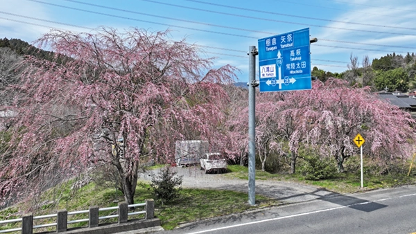 【Daigo Town, Shimonomiya】5 weeping cherry trees, along National Route 118
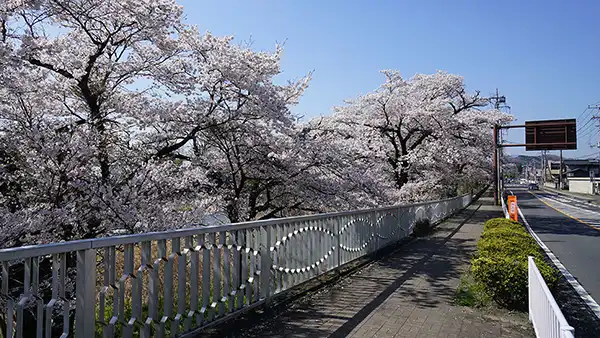
Ikeda Cherry Blossom Trees Along the Kuji River
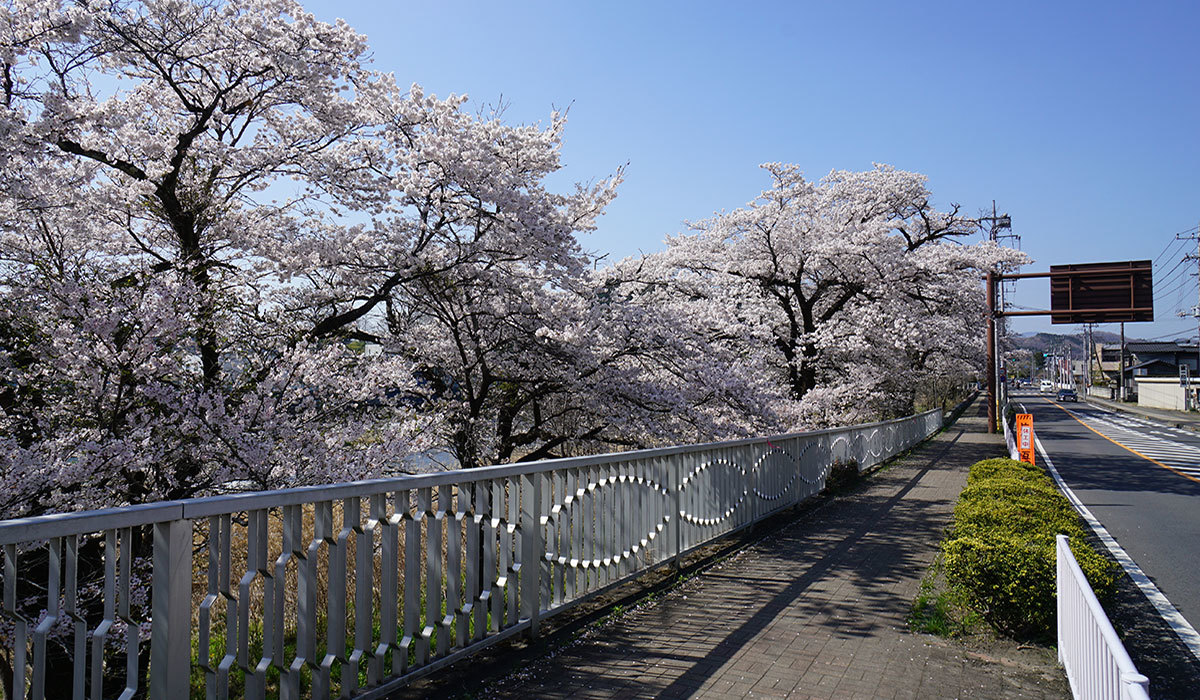 【Ikeda, Daigo Town】about 1 km of cherry blossom trees、Somei Yoshino、National Route 118
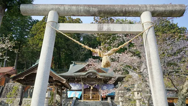
Cherry blossoms of Jūnisho Shrine
 【Daigo Town Daigo】Somei Yoshino cherry trees along the approach path, old Somei Yoshino cherry trees on the temple/shrine grounds
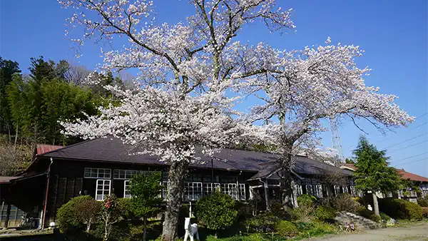
Cherry blossoms at former Kamioka Elementary School
 【Daigo-machi Kamioka】Founded in Meiji 12 (1879), established in Meiji 44 (1911), wooden school building, Someiyoshino cherry trees
Kamaoka's Weeping Cherry Tree
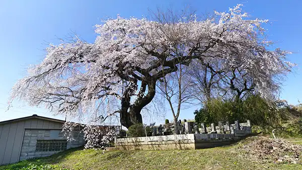 【Kamioka, Daigo Town】Hakamori Cherry Tree, Estimated age 300 years, Trunk circumference 4.6m
Kamioka's Edo Higan Cherry Tree
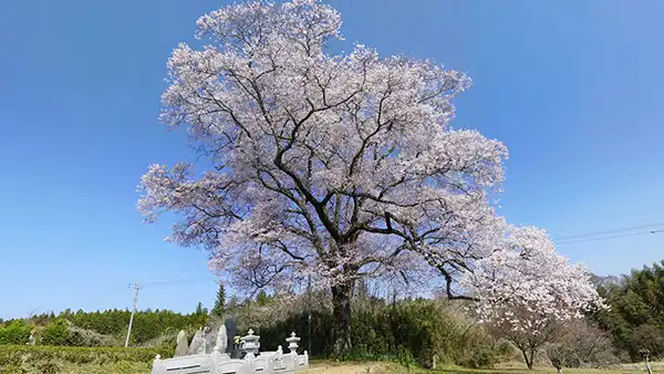 【Daigo Town, Kamioka】Hakamori Cherry Blossom, estimated age 300 years, trunk circumference 3.2m
Kawazu Cherry Blossoms at Okukuji Tea Village Park
 【Daigo-machi Sanuki】Early April, approximately 100 Kawazu cherry trees, Link to Ibaraki Kawazu Cherry Blossoms Guide
Aikawa's Botan-zakura
 【Aikawa, Daigo Town】along the Aikawa River, avenue of double-flowered cherry trees
Aikawa 321's weeping cherry tree
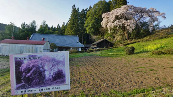
 【Daigo Town Aikawa】Shimogo Area Cherry blossoms at a private residence, Aikawa 321
Aikawa 1156's weeping cherry
 【Daigo Town Aikawa】Edo Higan, trunk circumference 4.1m
The Weeping Cherry Tree at Aikawa 1645
 【Daigo Town Aikawa】 Kamigo District, Hakamori Cherry Blossom, Aikawa 1645, Giant Wild Cherry Tree
Daigo Town's Cherry Blossom Viewing Spots VR Tour Map
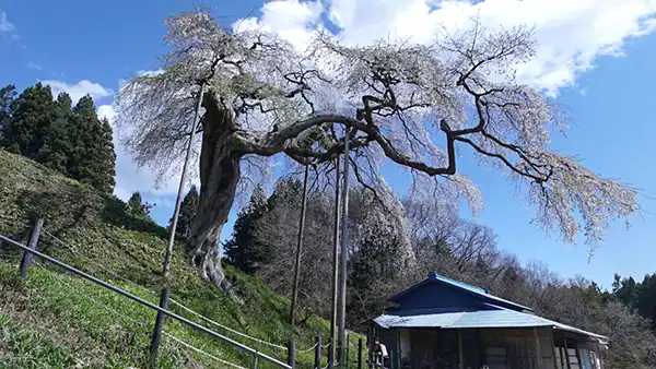
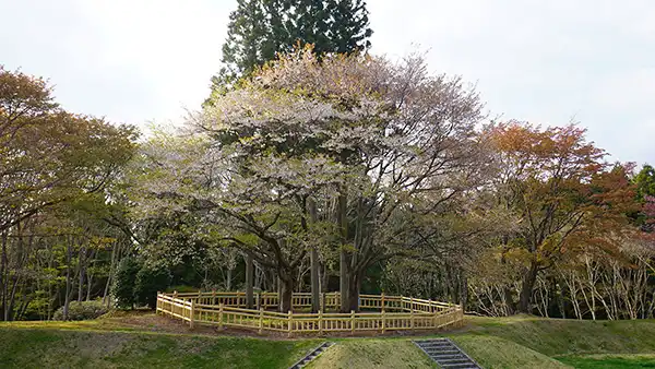
Soto-Ono Weeping Cherry Blossoms and Cherry Blossom Festival: Daigo Town's famous cherry blossom viewing spot

外大野のしだれ桜の南側からの景観とVRツアーの説明
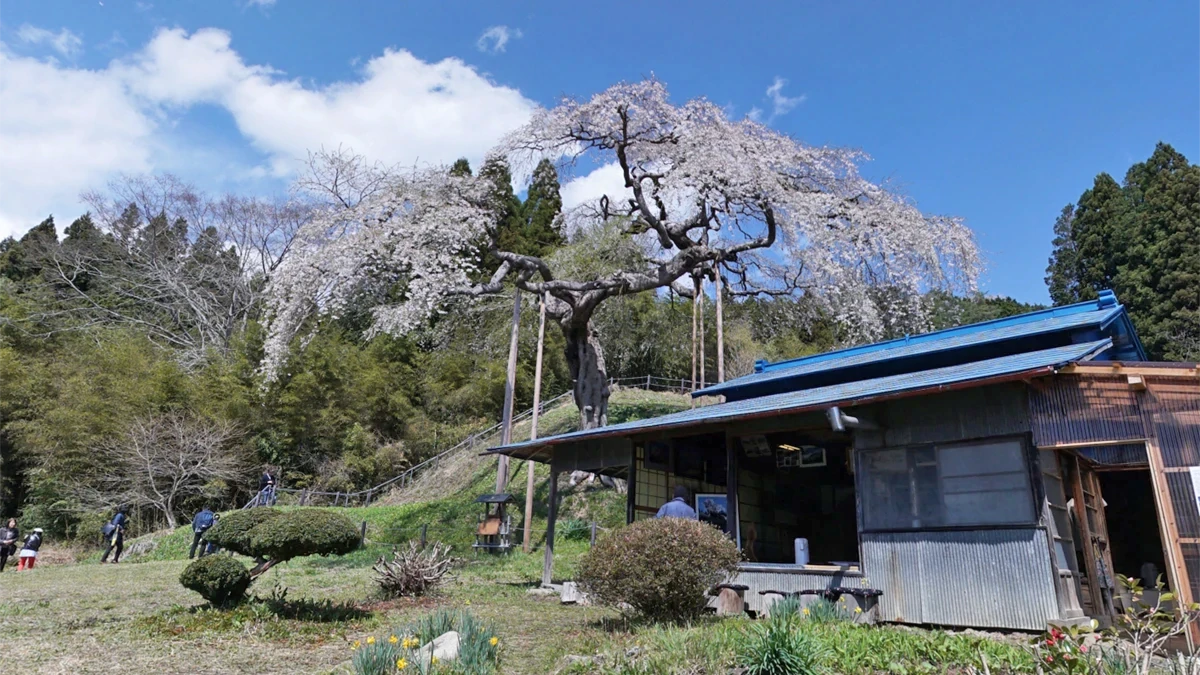
外大野のしだれ桜は、しだれ桜の回りに保護柵と小径があり、遠巻きに歩けるようになっています。手前の小屋でお茶を飲みながら休憩もできます。写真をクリックしVRシーンをご覧いただくと、この写真の反対側で大福や草餅等の物産を販売しているのを確認できます。
外大野は、日本の原風景が残る場所です。草もちを食べながら日本茶を飲み、300年以上のしだれ桜をのんびり眺めることができるおすすめ花見スポットです。
外大野のしだれ桜VRツアー案内は、空撮145m、空撮西側50m、しだれ桜東側・休憩小屋前、しだれ桜東側・水芭蕉と池のパノラマ写真をVRでご覧いただけます。
Wild Cherry Blossom Clusters at Kutsukake Pass: A Famous Cherry Blossom Viewing Spot in Daigo Town

外大野のしだれ桜の地図
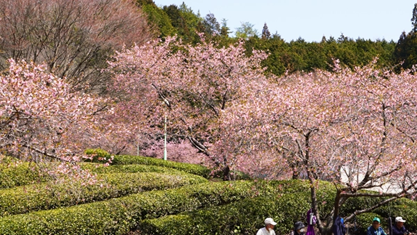
Mountain Cherry Blossoms at Okukuji Ikoi-no-Mori: Daigo Town's Famous Cherry Blossom Spot
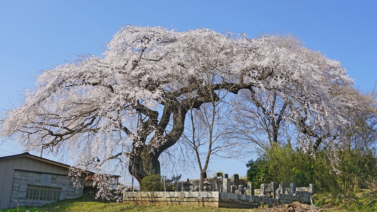
Onamase Jizo Cherry Tree (Weeping Cherry Tree): A famous cherry blossom viewing spot in Daigo Town

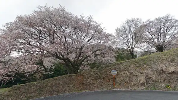
沓掛峠の山桜群の桜の空撮景観とVRツアーの説明

沓掛峠の山桜群の桜開花時の空撮景観写真です。山桜の開花の様子と小径が見えますが、拡大しているため26本の山桜は写っていません。写真をクリックするとVR写真で全体の景観をご覧いただけます。
沓掛峠の山桜群のVRツアーは、沓掛峠の山頂の地上景観、沓掛峠の道路側の山桜、沓掛峠の山桜斜面中央:空撮120m、沓掛峠の道路・駐車場145mの4件のVRシーンで構成されています。
なお、沓掛峠の道路・駐車場145mにおいてマウスで東側に合わせると空にリンクが表示されていますが、その下の方が外大野のしだれ桜で拡大すると見えます。リンクアイコンをクリックすると外大野のしだれ桜の上空に移動できます。外大野のしだれ桜までの道路距離は、約1.5キロメートルです。沓掛峠の山桜群と外大野のしだれ桜はセットで見学することが定番です。
Weeping Cherry Blossoms at Mannenbashi Bridge: Shimonomiya, Daigo-machi

沓掛峠の山桜群の航空写真地図
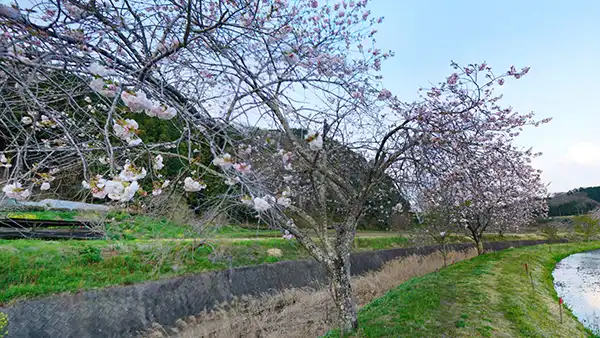
Cherry blossom trees along the Kuji River: Ikeda, Daigo Town
Jūnisho Shrine's Cherry Blossoms: A Popular Cherry Blossom Viewing Spot in Daigo Town
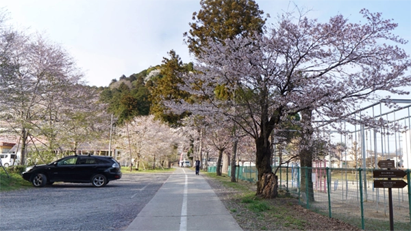
Cherry blossoms at Former Kamioka Elementary School: Kamioka, Daigo Town
奥久慈憩いの森の昭和天皇・皇后お手植えの山桜
奥久慈憩いの森の管理事務所付近の桜
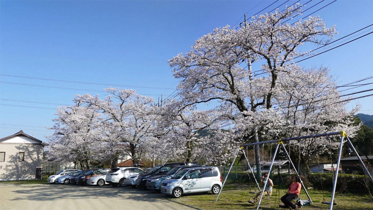
Kamioka Weeping Cherry Tree: Daigo Town's Cherry Blossom Viewing Spot
Kamioka's Edo Higan Cherry Blossoms

奥久慈憩いの森の地図
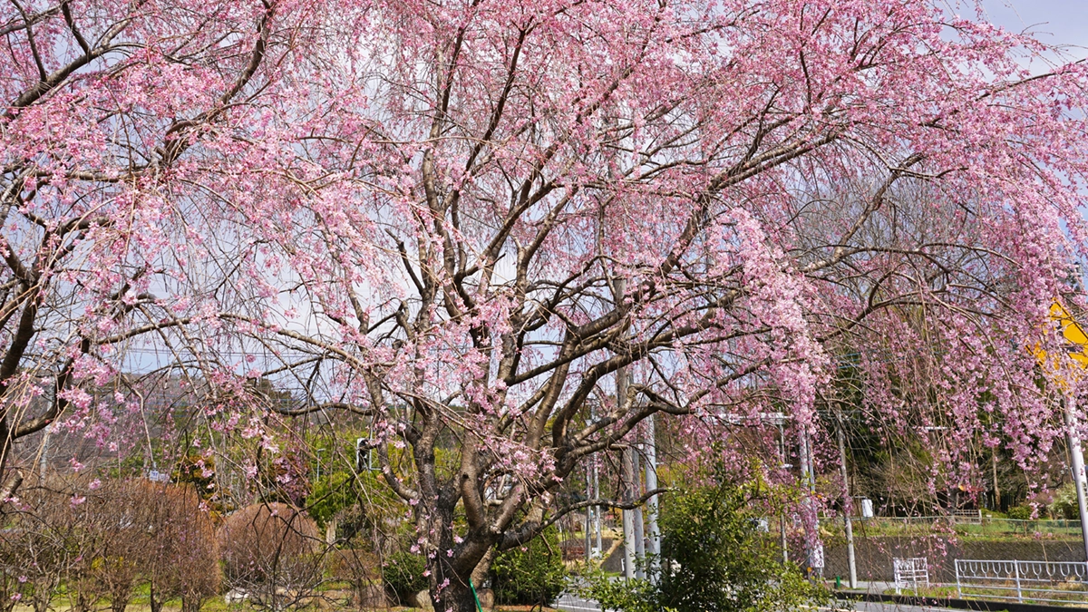
Aikawa's Double Cherry Blossoms: Aikawa, Daigo Town
Aikawa district is a famous cherry blossom viewing spot in Daigo Town, featuring not only rows of double-flowered cherry trees but also multiple weeping cherry trees (about 6), Yoshino cherry tree avenues, and more.
The double-flowered cherry trees in the Aikawa district of Daigo Town are located along a 1.6 km stretch of the Aikawa River, from the confluence with the Oshikawa River downstream upriver. As you can see from aerial photos in the aerial VR tour or the satellite view in Google Maps, there are some partially missing sections. The double-flowered cherry blossoms (Yaezakura) bloom relatively late, reaching their peak viewing time just when the rice paddies are being filled with water. This is a recommended cherry blossom viewing spot where you can enjoy the blossoms amidst a peaceful, rustic landscape.
Click on the photo to display the VR scene. The Aikawa district's double-flowered cherry blossom VR tour consists of 4 ground VR scenes and 1 aerial VR scene.
Best viewing periodAround mid-April
Location〒319-3534 Aikawa, Daigo-machi, Kuji-gun, Ibaraki
ContactDaigo Town Tourism Association:0295-72-0285
Aikawa 321 Weeping Cherry Blossoms: A Famous Cherry Blossom Spot in Daigo Town
小生瀬地蔵桜と子安地蔵堂等の景観とVRツアーの説明
小生瀬地蔵桜の入口の階段を上ったところの小生瀬地蔵桜と子安地蔵堂等周辺の景観写真です。写真をクリックすると、階段下の様子や目の前の小生瀬地蔵桜、並びに、説明板、文化財の表示板、ソメイヨシノの古木、西側にソメイヨシノ等の桜が植えられており、広場になっているのをご覧いただけます。
小生瀬地蔵桜のVRツアーは、空撮148メートルの1件と、階段登り口、 階段上と地蔵桜、 小生瀬地蔵桜の説明板、 ソメイヨシの前、 百日紅(サルスベリ)の古木、子安地蔵堂のVRシーン表示の地上6件のVRシーンで構成されています。
なお、丘の斜面は北東方面を向いており、階段も子安地蔵の建屋も正面は北東を向いています。子安地蔵正面(下側)から撮影する場合や子安地蔵堂を正面から撮影する場合は、南西向きに撮影することになるため午前中の撮影がおすすめです。
小生瀬地蔵桜の地図
Weeping Cherry Tree at Aikawa 1156: Aikawa, Daigo Town
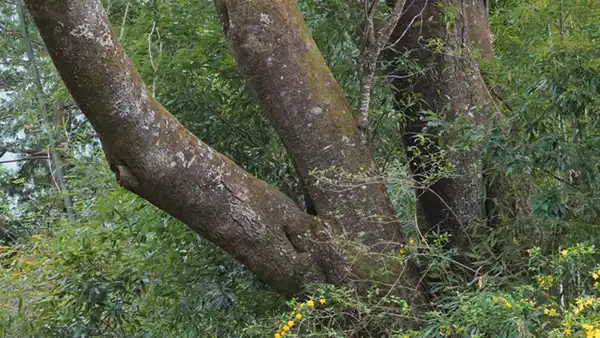
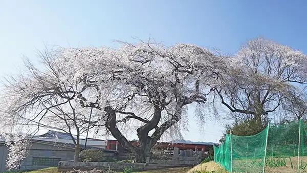
On the way to Aikawa 1465's weeping cherry tree, I saw a giant weeping cherry tree within a private residence from the road, so I stopped by to take a look. It appears to be a prominent family residence in a historic area, featuring a Nagayamon (long gatehouse).
Fortunately, there was someone working in the agricultural warehouse in front of the estate, so I was able to speak with them.
It was a relative from the neighborhood entrusted with its management, and they said that since the estate grounds are not maintained, it's fine to view and photograph the cherry blossoms from outside the property. According to online information, there seems to be an information board somewhere, but since I didn't enter the premises, it's unknown.
If you visit, please be aware that it is a private residence, so refrain from entering the estate grounds or surrounding fields. Also, if anyone is working around the estate, please speak to them. There is no parking, so caution is needed regarding on-street parking. Furthermore, regarding the weeping cherry tree at Aikawa 1156, please note that the trunk circumference and VR scenes have not been filmed, so they are not available for viewing.
※Weeping Cherry Blossom Information Species: Prunus itosakura 'Pendula', Age: Unknown, Height: 14m, Trunk Circumference at Eye Level: 4.2m
Best Viewing PeriodEarly April
Location:〒319-3534 茨城県久慈郡大子町相川1156
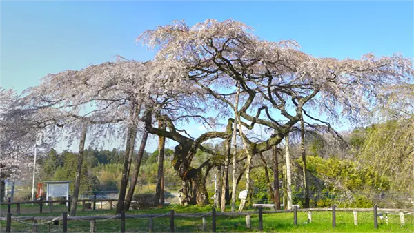
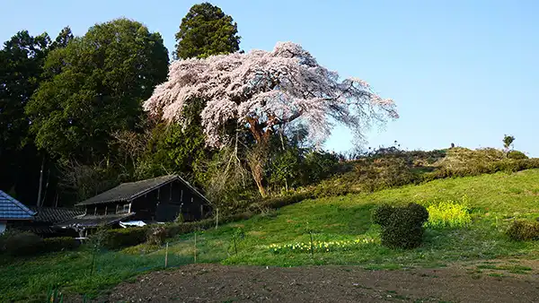
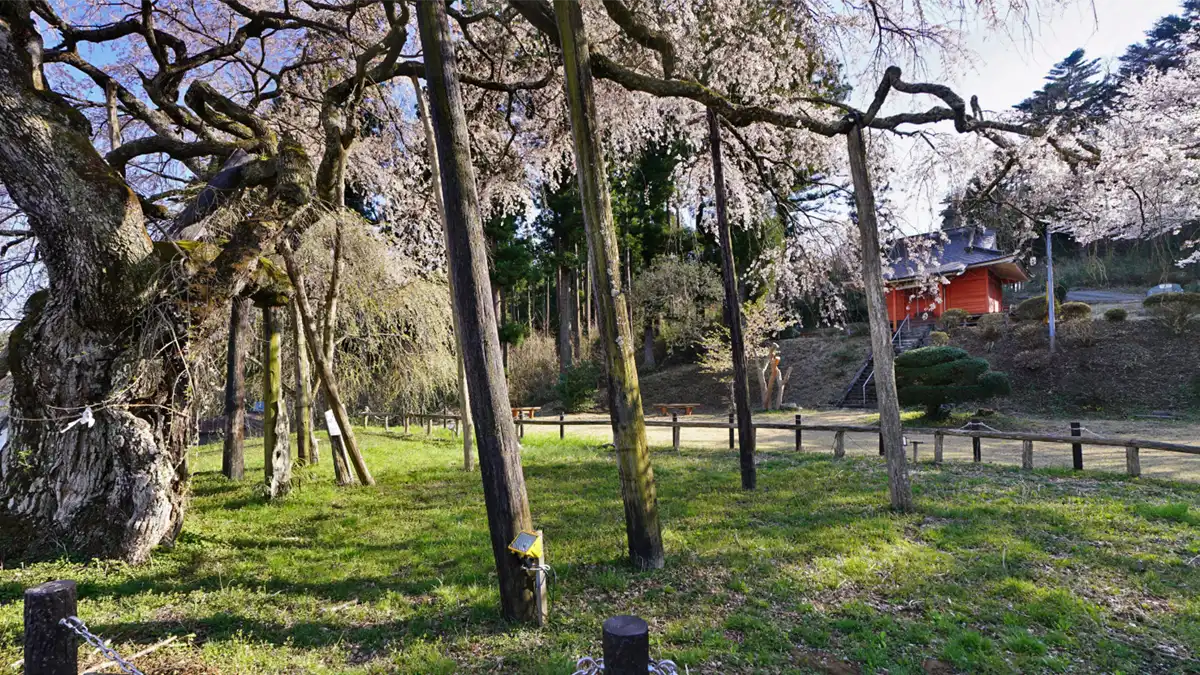
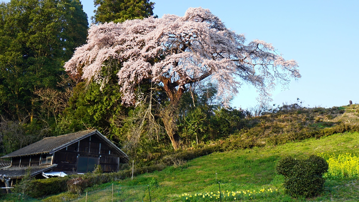
Southern view of the Weeping Cherry Tree at Aikawa 1156
 This is a photo of a weeping cherry tree in front of the mansion, taken near evening, and it's somewhat backlit by the setting sun. There's a farm road, wide enough for one car, that goes from the main street to the front of the mansion, and you can turn right there to get to the back.
View of the weeping cherry blossoms from the west
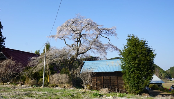
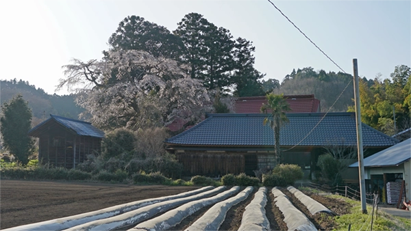
 This is a photo of the blooming weeping cherry tree at the Aikawa 1156 residence, taken from the path on its west side. There is a path in front of the residence's nagaya-mon gate that people can use to go west, and this photo was taken from somewhere along that path. It can also be accessed from the farm road on the west. As for the cherry blossom view, it is likely better from the west side.
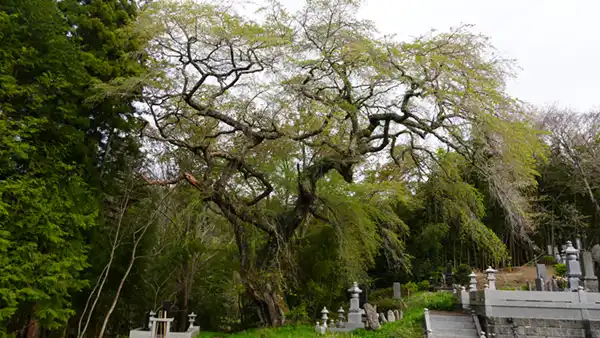
The giant weeping cherry and wild cherry trees at Aikawa 1465

敷地内からのしだれ桜の開花景観
Information on cherry blossom viewing spots in Ibaraki Prefecture other than Daigo Town
万年橋の地図
久慈川対岸からの桜並木の開花景観
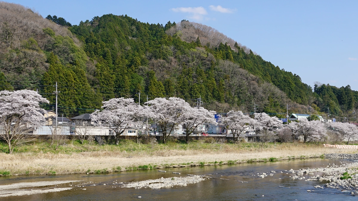
久慈川国道118号沿いの桜並木の周辺地図
十二所神社の参道の桜
十二所神社の地図
旧上岡小学校の校庭南側の桜開花景観とVRツアー説明
大子町上岡付近のおすすめ花見名所見学コース
旧上岡小学校の地図
上岡のしだれ桜の南東側からの景観
上岡のしだれ桜の地図
上岡の江戸彼岸桜の南側からの景観
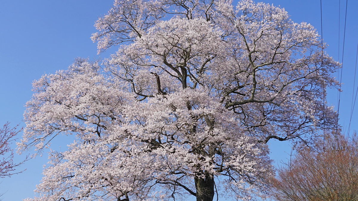
上岡の江戸彼岸桜の地図
相川のぼたん桜の地図
相川321のしだれ桜の空撮景観
写真は、大子町大字相川の字下郷の相川321のしだれ桜の空撮景観写真です。写真の下部に白く写っているのが相川321のしだれ桜です。写真の上部(西側)の右側、中央、左側に白く見えるのもしだれ桜の古木です。相川の下郷地区には、4か所のしだれ桜の1本桜があります。なお、中央に写っている川が相川です。相川は、南北に流れており、右側が北で下流方面です。相川のぼたん桜は、写真の中央部が最上流部です。写真をクリックしVR写真を拡大すると、まだ、咲いていないぼたん桜の木があるのが確認できます。ぼたん桜は、しだれ桜やソメイヨシノより、2週間ほど遅れて咲きます。
相川321のしだれ桜の地図
相川1156のしだれ桜の地図
相川の山桜の巨木・1本桜