Mt. Tsukuba Tourist Attractions and Recommended Sightseeing Spots Guide
List of Tourist Attractions on Mount Tsukuba
印刷
共有
30 Tourist Attractions and Recommended Spots
Click on the image to view information such as descriptions, photos, maps, and VR tours of the autumn foliage spots.
Mount Tsukuba Mount Nyotai(VR Tourism Starting Point)
 Elevation 877m, Tsukubasan Shrine Nyotaisan Hon Den, Mountain climbing and hiking
Mount Tsukuba, Mount Nantai (Tourist attraction)
 871m above sea level, Tsukubasan Shrine Nantai-san Main Hall, Mountaineering and Hiking
Gokyōgahara・Koma Observation Deck
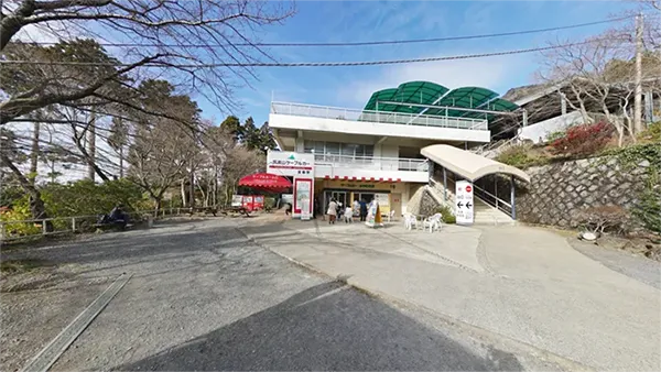
 Cable Car Summit Station, Koma Observatory, Teahouse and Rest Area
Shiho Sugi・Minano-gawa River Source
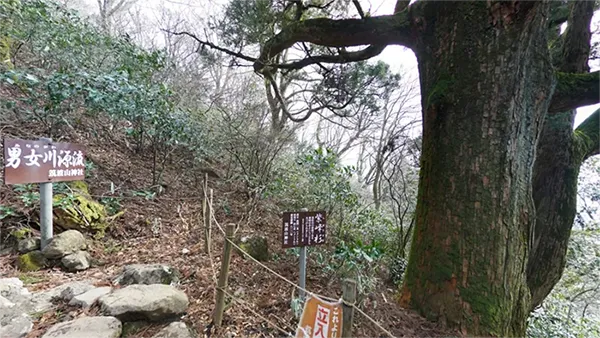 Miyukigahara, Headwaters of Minanogawa River, Shiho Sugi, Power Spot
Toad Stone
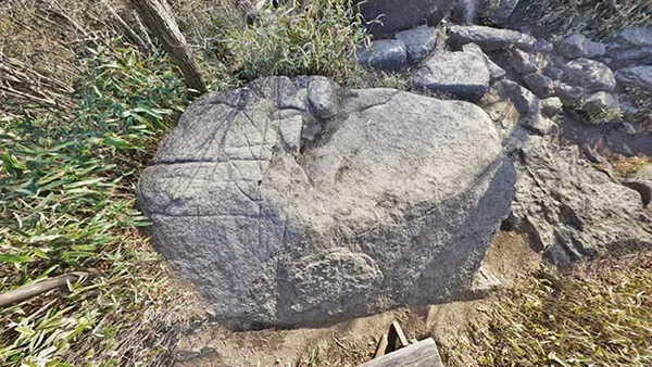
 On the summit connecting path, Unusual rock, Toad oil hawker's spiel, Power spot
Incoming and outgoing ships
 On the Mount Nyotai hiking trail, unusual gabbro rock formations, a power spot
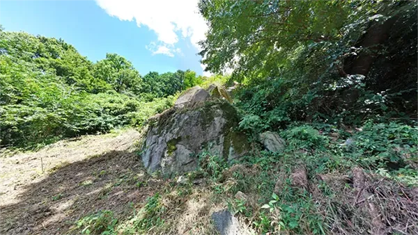
Country Dividing Stone
 On the Mt. Nyotai climbing course, unusual rock formations, a power spot for financial fortune and career success
Passing through the mother's womb
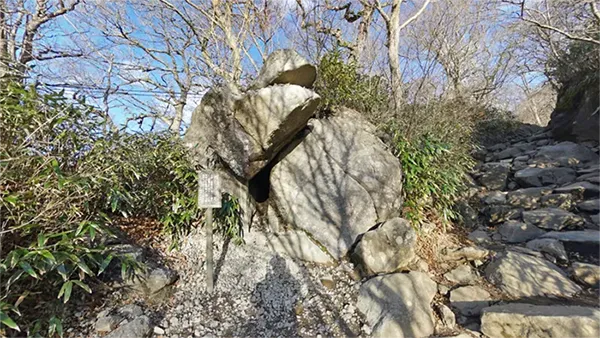
 On the Mt. Nyotai hiking trail, unusual rock formations, power spots, and ascetic training grounds for Tsukubasan Zenjo
Benkei's Seven Returns
 Mt. Nyotai climbing Otatsuishi Course , unusual rock formations, power spot
Tsutsujigaoka Plateau
 Mt. Nyotai Climbing Otatsuishi Course, rest area, azaleas, scenic viewpoint
Gama Daimyojin
 Mt. Tsukuba Tsutsujigaoka Parking Lot, Mt. Tsukuba Ropeway Station, First Sunrise of the Year
Ropeway・Tsutsujigaoka Parking Lot
 Mt. Tsukuba Ropeway, Otatsuiwa Course Trailhead, Parking Lot
Mount Tsukuba Cable Car Miyawaki Station
 Cable car station, 305m above sea level, observation deck, famous spot for autumn leaves
Mount Tsukuba Miyukigahara Course Trailhead
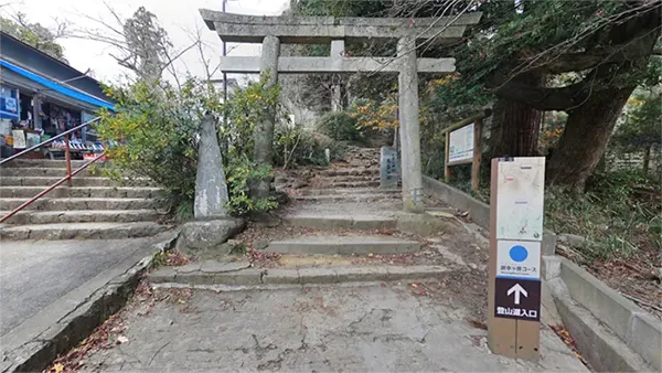
 Miyukigahara Course trailhead, Torii gate on the west side of Mount Tsukuba Shrine, Man'yoshu poetry monument
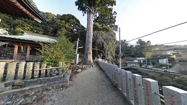
Shiraikumobashi Course・Mukaeba Course Trailhead
 Shira-kumo-bashi Course Trailhead, East side of Tsukuba-san Shrine
Tsukuba-san Tourist Information Center
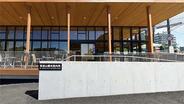 Tourist Information Center, Parking Lot, Public Restroom, Mt. Tsukuba Shrine Entrance (Bus Stop), Grand Torii Gate
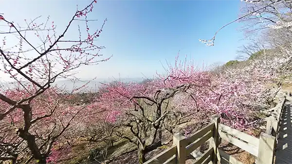
Mt. Tsukuba Plum Grove (tourist attraction)
 Plum Festival, Wintersweet, Hydrangea, Autumn leaves, View from the observation gazebo
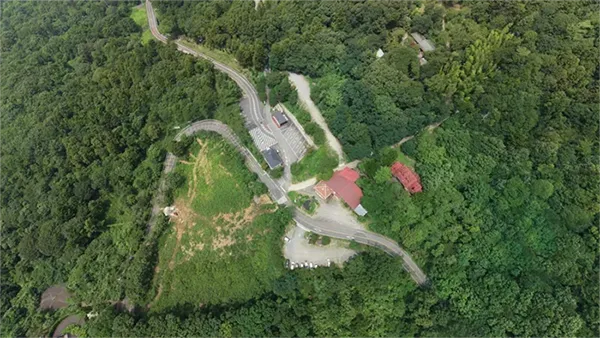
Gama Park
 Monument to the Origin of the Toad Oil Sales Pitch, Gama Daigongen, Winter Mountain Cherry Blossoms, Parking Lot
Tsukuba Road
 Tsukuba Road, the First Torii Gate of Mt. Tsukuba Shrine, the pilgrimage route to Mt. Tsukuba, the Former Mt. Tsukuba Post Office
Shirataki Shrine・Shirataki
 Mount Tsukuba foothills, power spot, two-tiered waterfall, Yamato Takeru, legend of the white swan, Mount Tsukuba Shirataki Road Hiking Course
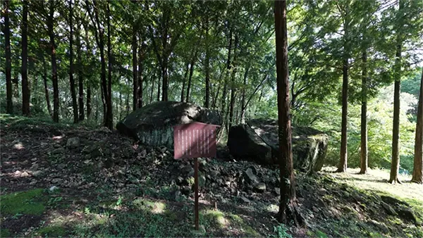
Tsukuba Fureai no Sato Fumegaishi
 Power spot, Tradition of Kakeai-uta (Utagaki), Man'yoshu
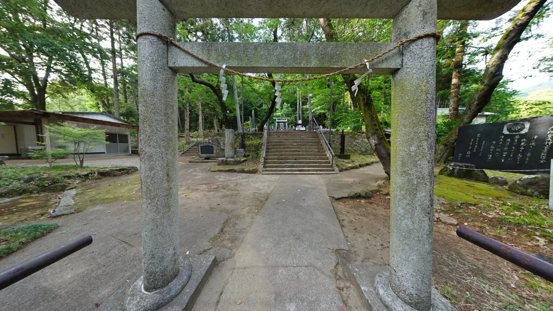
Rokushō Kōtaijingū Shrine Iwakura
 Foot of Mt. Tsukuba, power spot, views of the Usui and Kanzato districts
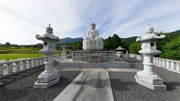
Rokushō Daibutsu
 Foot of Mount Tsukuba, Great Buddha, Introduction Monument to Rokushokotaizingu Shrine (History of the deity of Mount Tsukuba, etc.)
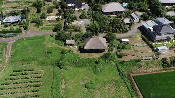
Green Tourism Rokushono House
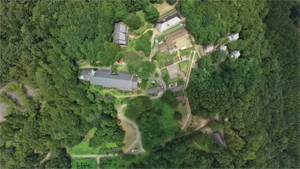
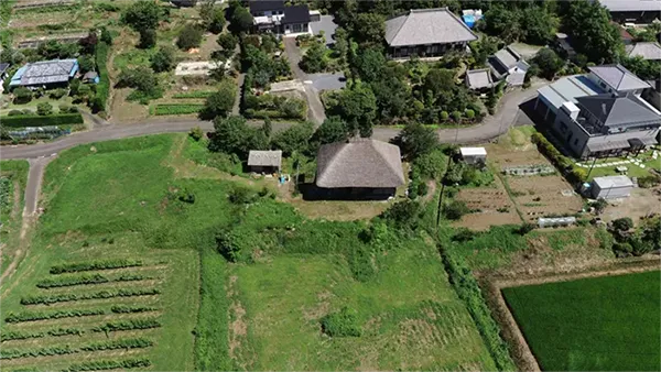 Thatched-roof traditional Japanese house, activity base of the Tsukuba Mountain Foothills Green Tourism Promotion Council
Rinrin Road Tsukuba Rest Area
 Cycling road, Cherry blossoms (seasonal attraction)
Tsukuba-Yamaguchi Bus Terminal
 At the foot of Mount Tsukuba, adjacent to Numata bus stop (Tsukuba-san Shuttle Bus), a key tourist spot
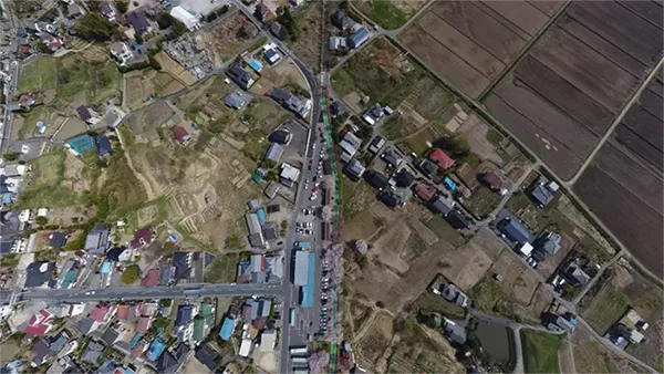
Kunimatsu Intersection: A key point for Mount Tsukuba tourism
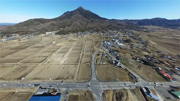 Prefectural Road No. 214 Numata-Shimotsuma Line, Prefectural Road No. 14 Chikusei-Tsukuba Line, Prefectural Road No. 42 Kasama-Tsukuba Line
Seasonal Tourism Categories for Mount Tsukuba
Mount Tsukuba's Cherry Blossom Viewing Spots (14 locations)
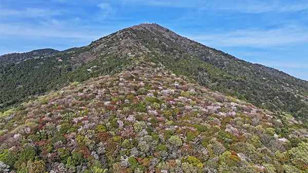 Mainly Mount Tsukuba, but it also includes the foothills of the Tsukuba Mountains in Tsukuba City, extending to Mount Hōkyō. There are wild cherry trees (Yamazakura), Somei Yoshino cherry trees, double-flowered cherry trees (Yaezakura), weeping cherry trees (Shidarezakura), and Kawazu cherry trees.
Mount Tsukuba's Famous Autumn Foliage Spots (20 spots)
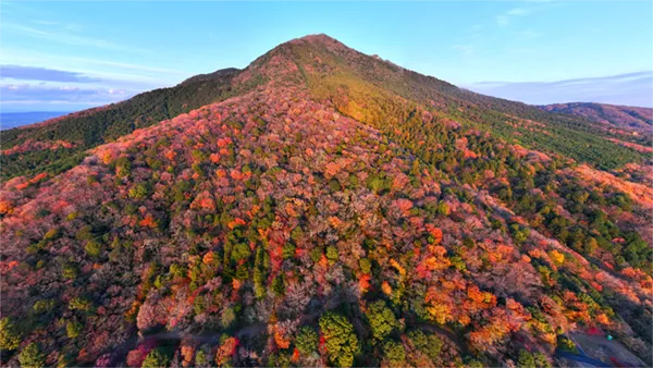 It mainly covers Mount Tsukuba, but also extends to the foothills of the Tsukuba Mountains up to Mount Hōkyō. The overall autumn foliage landscape of the mountains includes sawtooth oak, mountain cherry, maple, lacquer trees, etc., but the main attraction is the maple leaf viewing spots.
Tsukuba Night View/Illumination (6件)
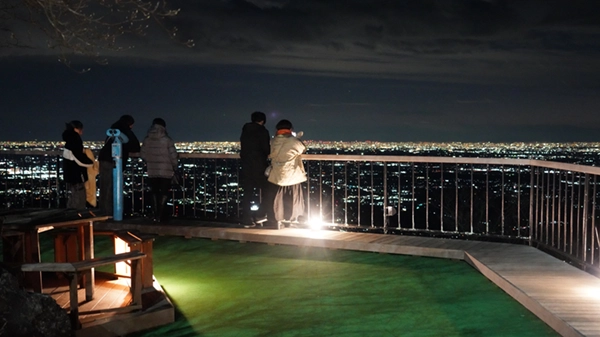 Night view: summits of Mount Nantai and Mount Nyotai, Koma Observation Deck, etc., November Illumination: cable car, Miyawaki Station
Sunrise / First Sunrise at Mount Tsukuba (8)
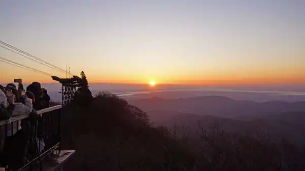 Sunrise spots on Mount Tsukuba, such as Mount Nantai, Mount Nyotai, Miyukigahara, Tsutsujigaoka, and Mount Hokyo
List of VR Navigation Videos for Mt. Tsukuba Sightseeing
印刷
共有
9 Recommended Tourist Spot VR Videos
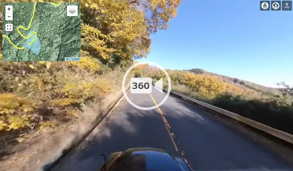
Up to Asahi Pass on the Fruit Line in Tsuchiura City
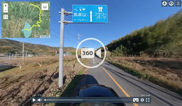 Car driving/sightseeing VR video, Asahi Tunnel Minami Intersection → Asahi Toge Intersection
VR video from Asahi Toge to Fudo Toge
 Car driving・Sightseeing VR video, Asahi Pass Intersection→Fudo Pass
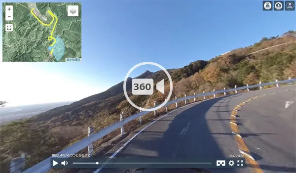
From Fudo Pass to Kazagaeshi Pass
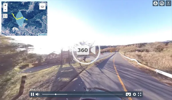
 Car Driving/Sightseeing VR Video, Fudo Pass → Mt. Tsukuba Kazakaeshi Pass, Omote-Tsukuba Skyline
From Obata, Ishioka City to Kazekaeshi Pass
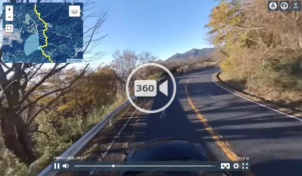
 Car Driving/Sightseeing VR Video, Yasato, Ishioka City → Mt. Tsukuba Kazekaeshi Pass
VR video from Kunimatsu Intersection to Mt. Tsukuba Shrine
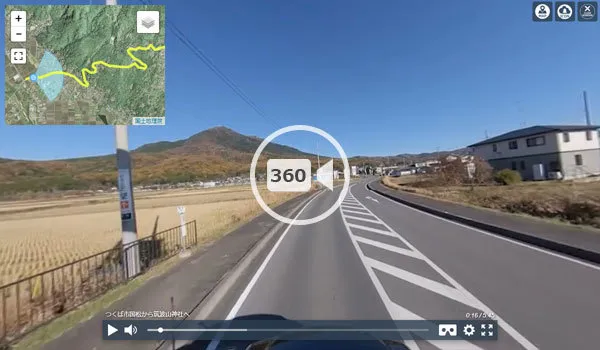 Car Driving and Sightseeing VR Video, from Kunimatsu, Tsukuba City to Mt. Tsukuba Shrine
VR video from Tsukubasan Shrine to Kazekaeshi Pass
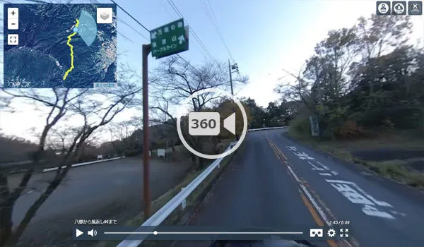
 Car driving & sightseeing VR video, Mt. Tsukuba Shrine → Kazekaeshi Pass
From Kazekaeshi-toge to Tsutsujigaoka
 Car Driving & Sightseeing VR Video, Mt. Tsukuba: From Kazekaeshi Pass to Tsutsujigaoka
Mount Nyotai Summit・Shrine
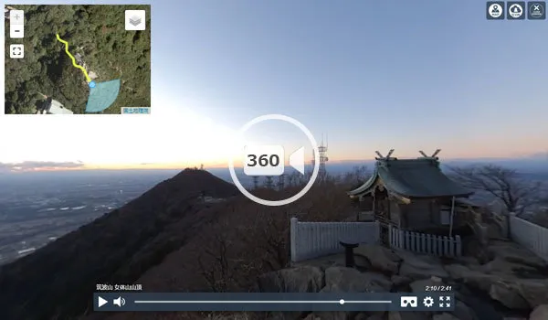 Walking and Sightseeing VR Video: Magnificent Sunset View from Mt. Nyotai Summit, Mt. Tsukuba
Mount Tsukuba Plum Grove
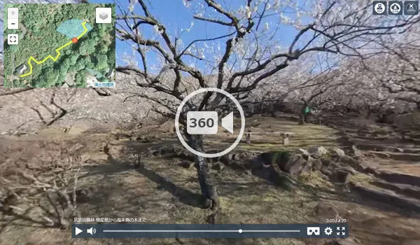 VR video for walking and sightseeing, Fukuraiume tree
Mount Tsukuba Tourist Attractions VR Tour Map and Transportation Access
共有
筑波山への交通アクセス
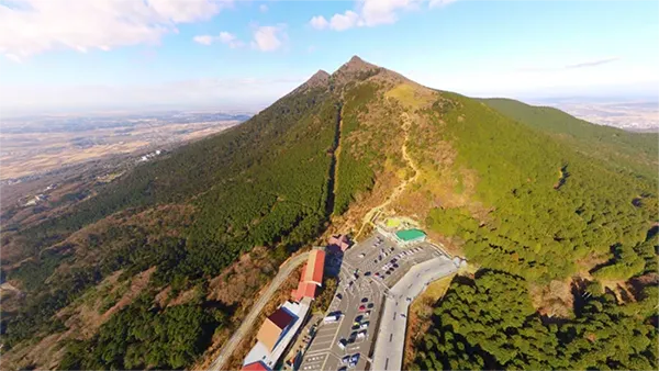
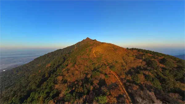
Mount Nyotai: A Famous Spot for Sightseeing, Hiking, and Sunrise Viewing
印刷
共有
春夏秋冬Wild cherry blossoms (April)・Fresh greenery・Autumn leaves (November)・Views of Mt. Fuji・Night views・Mountain climbing・Hiking
Starting Point for Mt. Tsukuba VR Tour
Mt. Nyotai is the starting point for the Mt. Tsukuba VR tour, allowing you to access aerial VR views of all tourist spots on Mt. Tsukuba. It also serves as a starting point for nearby municipalities' tourism, and from here, you can navigate to proximate recommended tourist spots among the 16 recommended tourist attractions in Ibaraki Prefecture.
- (1) Tourist Information for Mt. Nyotai (Starting Point)
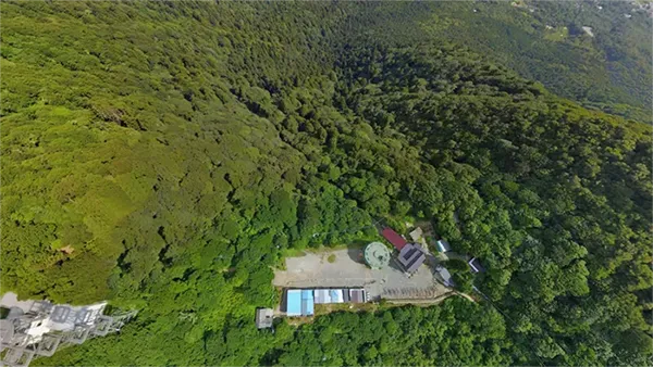
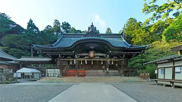
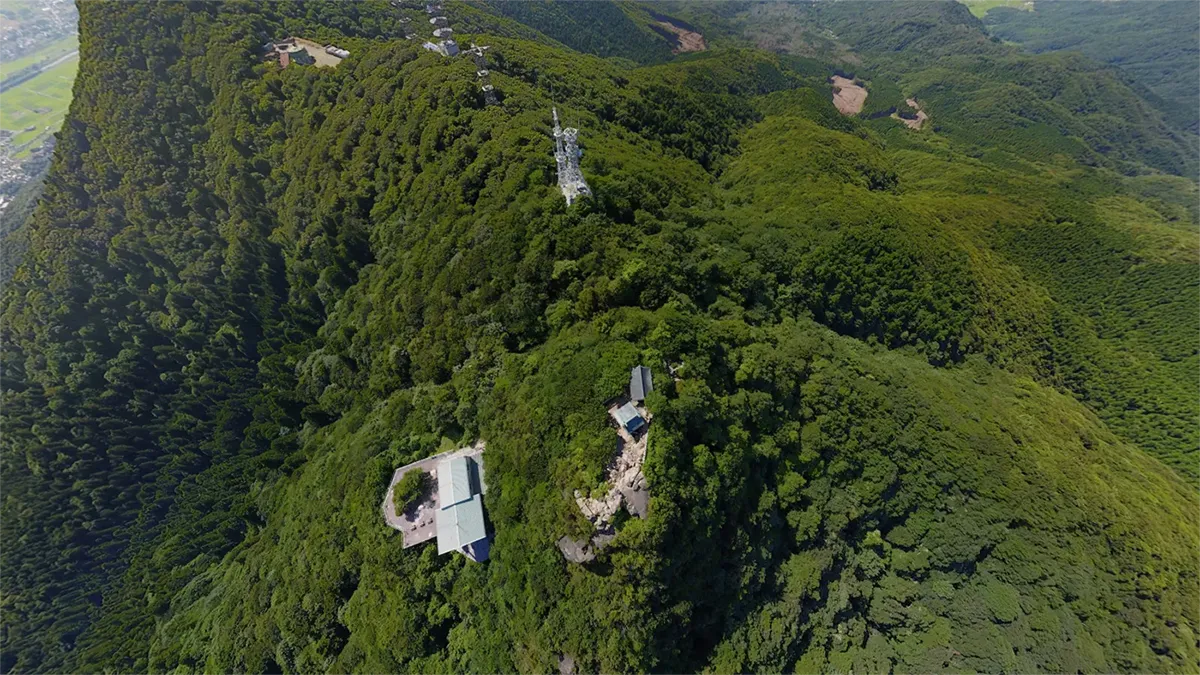
- Mt. Nyotai is a famous tourist spot on Mt. Tsukuba, forming the eastern peak of Mt. Tsukuba, which consists of two peaks, east and west. It has an elevation of 877m, and at its summit is the main shrine of Tsukuba-san Shrine, Nyotai-san Honden. Two easy climbing routes to Mt. Nyotai's summit are available: one from Tsukuba-san Shrine by cable car to Miyukigahara, and then on foot to Mt. Nyotai's summit; and another from Tsutsujigaoka by ropeway directly to Mt. Nyotai's summit.
- (2) Explanation of Mt. Nyotai Tourist VR Tour
- The image above is a VR of an aerial 360° panoramic photo taken 143m above Mt. Nyotai's summit. The recommended Mt. Nyotai VR tour consists of an aerial view at 143m, Tsukuba-san Shrine Nyotai-san Honden, and the climbing trail from Miyukigahara.
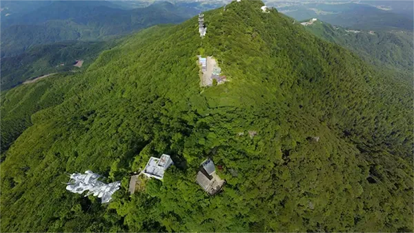
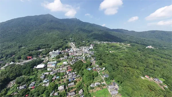
Mount Nantai:A popular destination for sightseeing, mountain climbing, and hiking
印刷
共有
春夏秋冬Mountain cherry blossoms (April)・Fresh green leaves・Autumn leaves (November)・Viewing Mt. Fuji・Night view・Mountain climbing・Hiking
女体山の山頂地図
Miyukigahara: Sightseeing, Hiking, Night views, Sunrises
印刷
共有
春夏秋冬Mountain Cherry Blossoms(4月)・Dogtooth Violet(5月)・Autumn Leaves(11月)・Night View・Mountain Climbing・Hiking

Shiho Cedar・Minanogawa River Source: Tourist Attractions of Mount Tsukuba
印刷
共有
春夏秋冬Fresh greenery and spring water

Gamaishi: A famous spot on Mt. Tsukuba
印刷
共有
春夏秋冬Autumn foliage (November)・Mountain climbing・Hiking

男体山の付近地図
Departing and Arriving Ships: Unique Rock Formations and Power Spot on Mt. Tsukuba
印刷
共有
Kuniwariishi Stone: Mount Tsukuba's Unique Rock Formation and Power Spot
印刷
共有

御幸ヶ原の付近地図
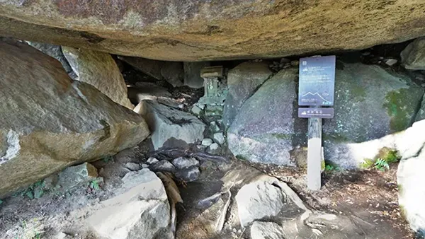
Passage through the Mother's Womb: Unique Rock Formations and Power Spots
印刷
共有

紫峰杉・男女川源流の付近地図
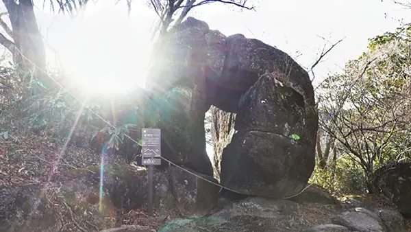
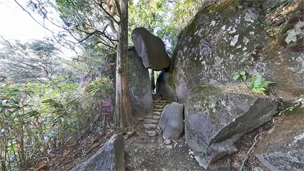
Benkei Nana Modori: A famous spot and power spot on Mount Tsukuba
印刷
共有
Tsukuba-san Cable Car Miyawaki Station
印刷
共有
春夏秋冬Wild cherry blossoms (April)・Fresh green leaves・Autumn leaves (November)
ガマ石の付近地図
Mount Tsukuba Tsutsujigaoka Parking Lot / Trailhead
印刷
共有
春夏秋冬Autumn leaves of mountain cherry (April)・Fresh greenery・Autumn leaves (November)・Mountain climbing・Hiking

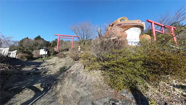
Tsutsujigaoka's Gama Daimyojin: Recommended Spot
印刷
共有

出船入船の付近地図
Tsutsujigaoka Plateau on Mount Tsukuba
印刷
共有
春夏秋冬Mountain cherry blossoms (April)・Azaleas (May)・Autumn leaves (November)・View
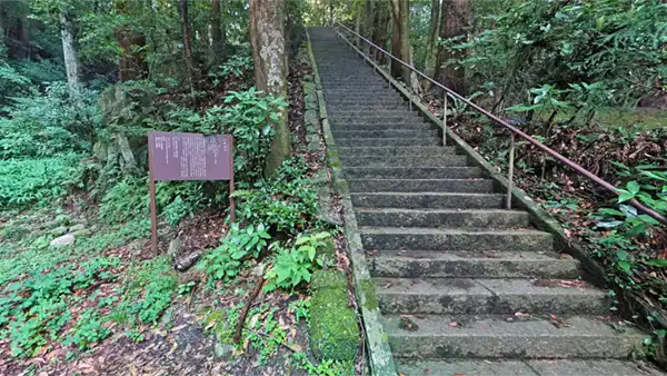
Mount Tsukuba Miyukigahara Course Trailhead: Climbing / Hiking
印刷
共有
Mt. Tsukuba Shiraunbashi Course and Mukaiyama Course Trailhead
印刷
共有
国割り石の付近地図
Mount Tsukuba Tourist Information Center: Information and Rest Spot
印刷
共有

Mount Tsukuba Plum Grove: A Tourist Spot for All Seasons
印刷
共有
母の胎内くぐりの付近地図
Gama Park・Parking: Recommended Spots
印刷
共有
弁慶七戻りの付近地図
Tsukuba Road: Recommended Geographical Landscape Spots
印刷
共有
Tsukuba Fureai no Sato・Fumegaishi: Recommended Spots
印刷
共有
筑波山ケーブルカー宮脇駅の付近地図
Rokushō Kōtaijingū Sacred Site's Iwakura: Recommended Spot
印刷
共有
春夏秋冬Cherry blossoms (April)・Fresh greenery・Autumn leaves (November)

Rokusho Daibutsu: Recommended Sightseeing Spots
印刷
共有
筑波山つつじヶ丘駐車場・登山口の付近地図
Thatch-roofed Old Folk House ・ House of Rokushō
印刷
共有
Rinrin Road Tsukuba Rest Area
印刷
共有
ガマランドの付近地図
Bus Terminal Tsukubayamaguchi: Tourist Transportation/Cherry Blossom Spot
印刷
共有

Kunimatsu Intersection: Tourism Geography・Scenic Spot
印刷
共有

This page provides tourist information for Mount Tsukuba in Tsukuba City. The scope covers the area from the summit of Mount Tsukuba to its base. Tourist information for Mount Tsukuba on the Ishioka City side and Mount Tsukuba on the Sakuragawa City side is provided on separate pages.