Guide to Tourist Attractions and Recommended Sightseeing Spots in Tsukuba City
Tsukuba City Tourism News
Recommended Early Summer Flower Sightseeing in Tsukuba City
Currently blooming as of June 4, 2025
Roses at Tsukuba Rose Garden
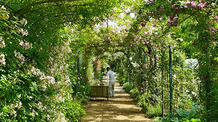 Mid-May to Early June
Anabel Rose Garden
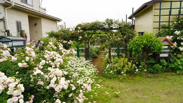 Mid-May to Early June
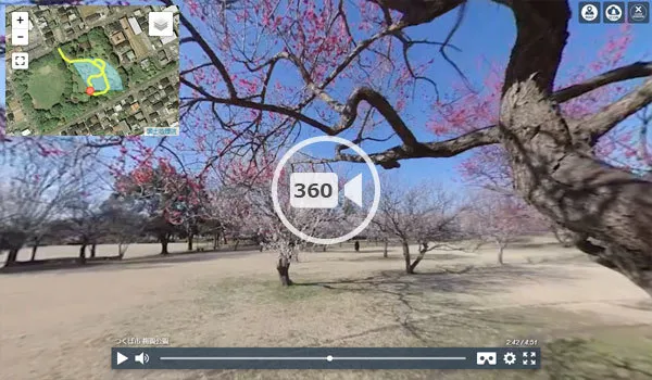
Hydrangeas at Tsukubasan Bairin
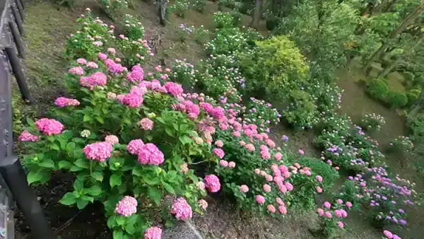 Hydrangea Festival: Early to Mid-June
List of Tourist Attractions and Recommended Spots in Tsukuba City
41 Tourist Attractions and Recommended Spots (770 scenes)
Tsukuba City has many tourist attractions and recommended spots, and the following are those for which interviews and registration have been completed.
Tsukuba Center Building (Tourism Hub)
 Tsukuba Station on the Tsukuba Express, bus terminal, pedestrian deck
Tsukuba Expo Center
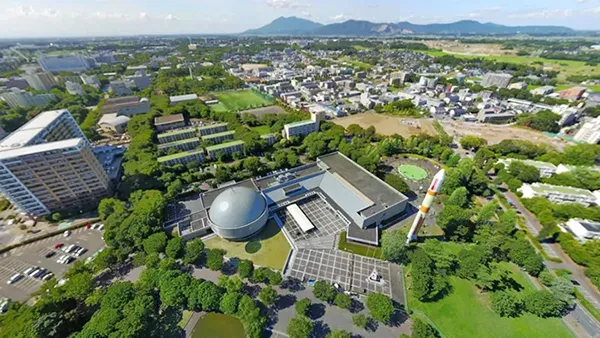 Science experience/tour, world's largest planetarium, H-II rocket
Mount Tsukuba (Tourism, Hiking, Leisure)
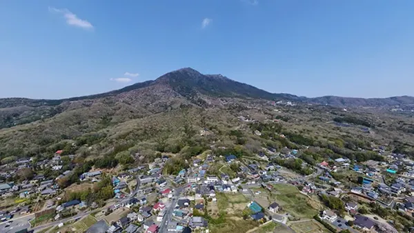 Mount Nantai, Mount Nyotai, Tsukuba-san Shrine, Tsukuba Plum Grove, Tsukuba Fureai no Sato, etc.
Link to this site's Mount Tsukuba sightseeing park page.Tsukuba Plum Grove (Tourist Attraction)
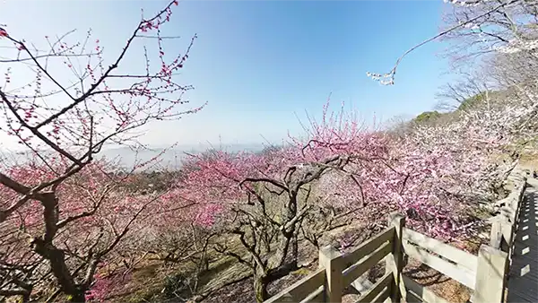 Wintersweet, plum, cherry blossoms, hydrangeas, autumn leaves,Link to Tsukuba Plum Grove information on Mount Tsukuba's tourist guide page.
Oda Castle Ruins (National Historic Site)
 National Historic Site, Oda Castle Ruins History Plaza, tourist information center
Hirasawa Kanga Ruins (National Historic Site)
 Ruins of Gun-ga (district office) in Tsukuba District, Hitachi Province (National Historic Site), reconstructed raised-floor warehouse
Tsukuba City Oike Park (Seasonal Tourism)
 Hojo Oike Pond, cherry blossoms, lotus, camellia (seasonal tourism), fishing
Mount Hōkyōsan (Hiking/Historical Tourist Attraction)
 Hiking, Hōkyōintō Pagoda, cherry blossoms, kobushi magnolias, autumn leaves, New Year's sunrise
Hōkyōsan Oda Rest Area
 Near "Hōkyōsan Iriguchi" bus stop, free parking,
Stone Jizo Bodhisattva Statue (Famous Spot)
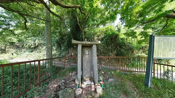 Ibaraki Prefectural Designated Cultural Property Historic Site, Kamakura period, maple trees, Hōkyōsan Gokurakuji Temple Course
Gokurakuji Park (Original Landscape)
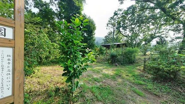 Mount Hōkyōsan, Gokurakuji Hiking Course, Gokurakuji explanatory signboard, Owl Gallery
Gokurakuji Park Gorinto: Historic Site
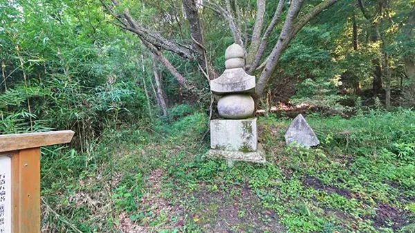 Hokyo-san at Gokurakuji ruins, Gokurakuji hiking course, Tsukuba City Designated Cultural Property
Ring Ring Road (Seasonal Tourism: Cherry Blossoms)
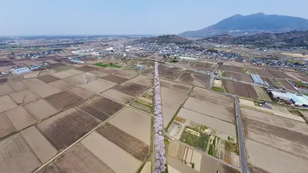 Cycling road Hojo area, cherry blossom trees
Hiuchiga Pond
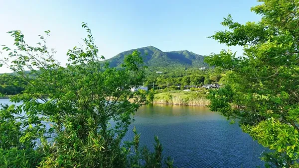 Agricultural reservoir at the foot of Mt. Tsukuba, photo spot
Tsukuba Hakusui Lake
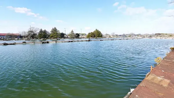 Managed fishing spot, crucian carp fishing, near Kokaigawa River
Water Lilies at Ippai-kan Pond
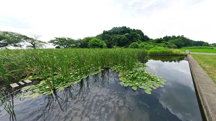 Water lilies, cherry blossoms, crucian carp fishing
Takasaki Nature Forest
 Nature observation, moss phlox, double cherry blossoms, water lilies, autumn leaves
Gokakudo (Historic Sightseeing/Building)
 Pentagonal building, Ibaraki Prefecture Designated Historic Site, Iizuka Iganana
Mimori Castle Ruins
 Residence of Taira no Masakado's uncle, Taira no Yoshimasa, stone monument of Taira clan lineage
Tegomaru Castle Ruins
 Tsukuba City Designated Cultural Property, branch castle of Oda Castle, Oda Ujiharu, Sugaya Norimasa
Numata Hachimanzuka Kofun (Historic Sightseeing)
 Largest keyhole-shaped kofun in the Tsukuba region, Ibaraki Prefecture Designated Historic Site
Satsuga Iwaya Kofun
 Tsukuba City Designated Historic Site, 7m high square kofun, Taira no Masakado's daughter, Takiyasha-hime
Kurihara Atagozuka Kofun
 Circular kofun with a diameter of approx. 20m and height of approx. 4m, Atago Shrine
Ichinoya Kofun Group, Tsukuba City
 Two kofun within the grounds of Ichinoya Yasaka Shrine, Dainichi-sha (sub-shrine)
Keicho Itabi
 Tsukuba City Designated Cultural Property, built in Keicho 8 (1603), Nikki Machi Joju-hi (monument for achievement of a diary/wish)
Sudajii Tree at Tsukuyomi Shrine
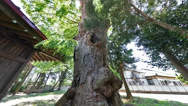
 A giant tree approx. 700 years old, a power spot
Chinese Hackberry Tree at Kanamura Wake Ikazuchi Shrine
 Approach to Kanamura Wake Ikazuchi Shrine, a giant tree with a trunk circumference of 5.6m at eye level
Fudo Kaya Tree at Ichijoin Shinfukuji Temple
 An ancient Kaya tree over 800 years old, Fudo Myoo for lightning protection
Large Keyaki Tree at Kashima Shrine (Kurihara)
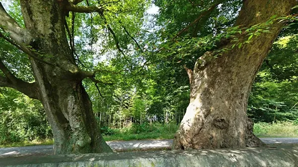
 Tsukuba City Designated Natural Monument, the second largest tree in Tsukuba City, with a trunk circumference of 7.3m at eye level and an estimated age of 480 years
Large Chinese Hackberry Tree at Hiuchiga Pond
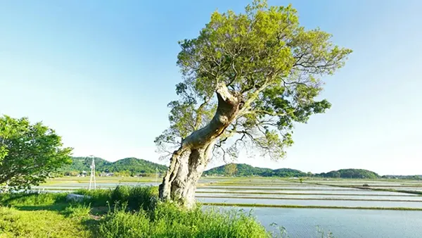 South side of Hiuchiga Pond, estimated age 300 years
Kokaigawa River: Fukurai Bridge
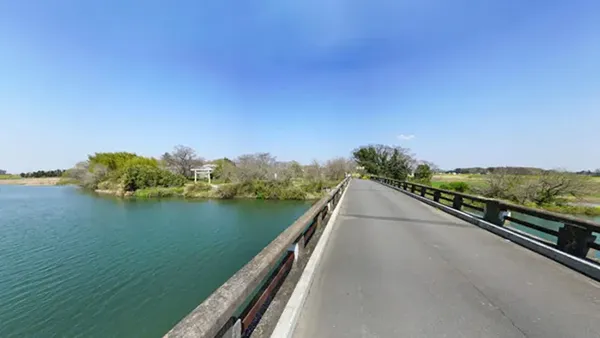 Kami郷, Tsukuba City ⇔ Fukuni-cho Otsu, Joso City; Kokaigawa River, location for movies and TV dramas
Sakura River: Ota Bridge (Mt. Tsukuba View)
 Osona, Tsukuba City ⇔ Kita-Ota; Sakura River, Prefectural Road No. 53 Tsukuba-Chiyoda Line
Sakura River: Tadobe Weir (Fishing/Nature View)
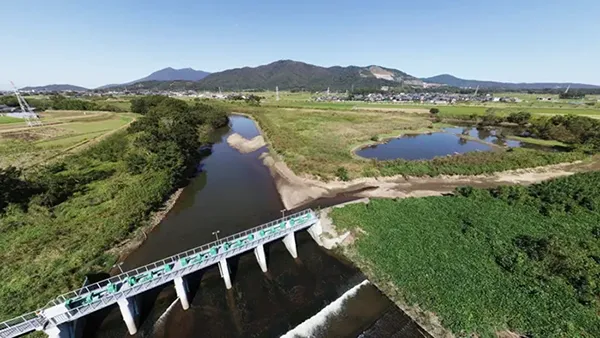 Sakura River, fishing (carp, crucian carp, catfish, etc.)
TX Tsukuba Station
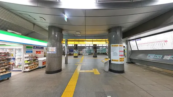 Tsukuba Express, Tsukuba City Tourist Information Center
Tsukuba Center Bus Terminal
 Highway buses, city buses, Mt. Tsukuba Shuttle Bus, taxis
Tsukuba Station Front Intersection
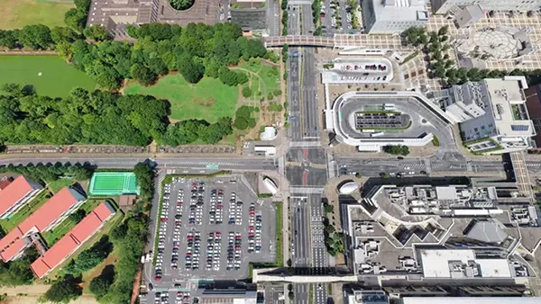 Prefectural Road No. 24 Gakuen Chuo-dori, TX Tsukuba Station, Tsukuba Center Bus Terminal
Nishiodori Iriguchi Intersection
 Intersection where Gakuen Higashiodori and Gakuen Nishiodori intersect
Yatabe Interchange
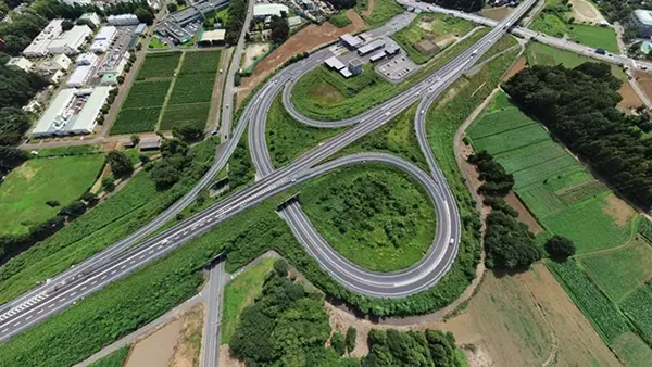
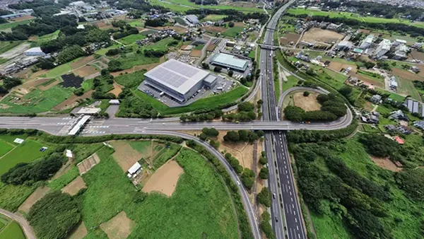 Joban Expressway, gateway to Tsukuba City from Tokyo
Tsukuba Chuo Interchange
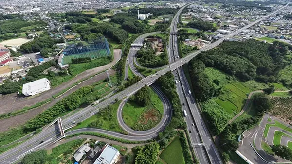
 Ken-O Expressway, Ibaraki Prefectural Road 19 Toride-Tsukuba Line
Sakura Tsuchiura Interchange
 Joban Expressway, National Route 354, Osodai Intersection
List of Recommended VR Videos of Tsukuba City Tourist Spots
9 Recommended Tourist Spot VR Videos
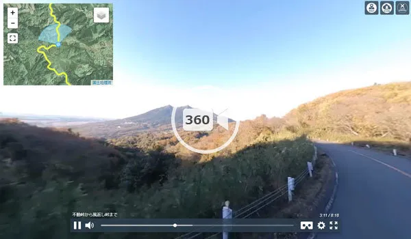
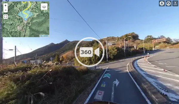
Road to Mt. Tsukuba Shrine (Sightseeing Road)
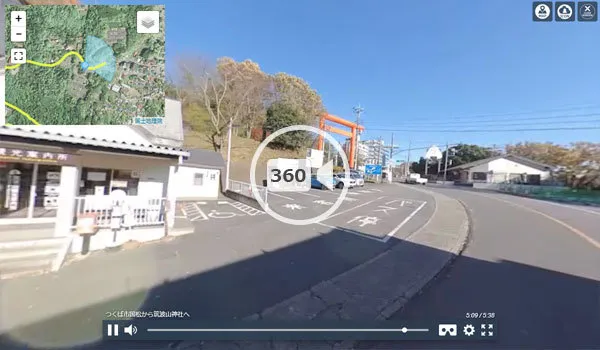 Car driving/sightseeing VR video, Kunimatsu, Tsukuba City → Mt. Tsukuba Shrine
Mt. Tsukuba Shrine → Kazakaeshi Ridge (Sightseeing Road)
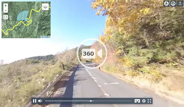 Car driving/sightseeing VR video, Mt. Tsukuba Shrine → Kazakaeshi Ridge
Omote Tsukuba Skyline (Sightseeing Road)
 Car driving/sightseeing VR video, Fudo Pass → Kazakaeshi Ridge
Tsukuba Skyline (Sightseeing Road)
 Car driving/sightseeing VR video, Mt. Tsukuba Kazakaeshi Ridge → Tsutsujigaoka
Mt. Tsukuba Summit/Shrine (Tourist Spot)
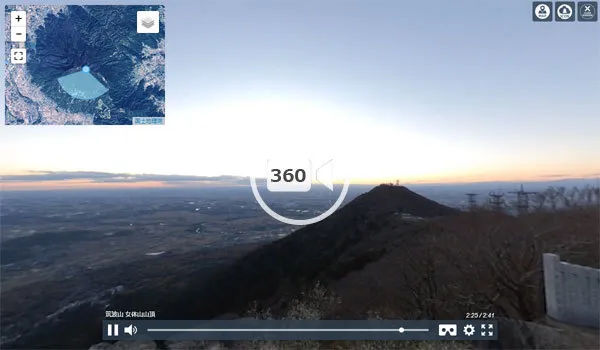 Walking/sightseeing VR video, Nyotaisan Summit, magnificent sunset view
Mt. Tsukuba Plum Grove (Seasonal Sightseeing)
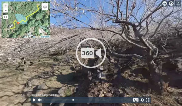 Walking/sightseeing VR video, Fukure Plum Trees
Umezono Park
 Walking/sightseeing VR video, numerous plum trees
Cherry Blossom Trees along Matsumi Street at University of Tsukuba
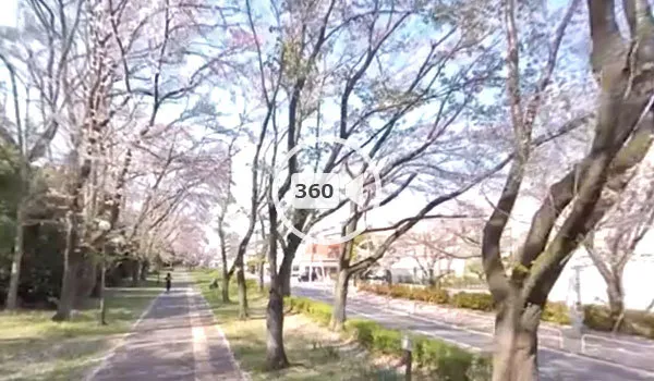 Matsumi Street, famous cherry blossom spot, bicycle riding/sightseeing VR video
Cherry Blossom Trees Near Japan International University
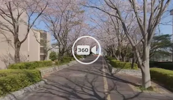 Tsukuba Park Street, walking/sightseeing VR video
List of Ground and Aerial Videos of Tsukuba City Tourist Spots
2 Recommended Tourist Spot Ground/Aerial Videos
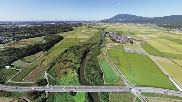
RinRin Road Cherry Blossom Trees
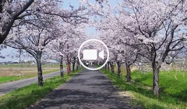 Aerial/tourism video, Tsukuba Kasumigaura Ring Ring Road, Mt. Tsukuba, Cherry blossoms
Cherry Blossom Trees at Hojo Oike Pond
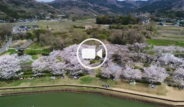 Aerial/tourism video, Hojo Oike Pond, Hirasawa Kanga Remains, Cherry blossoms
Tsukuba City Tourism VR Tour Map and Access Guide
Main Tourist Access to Tsukuba City
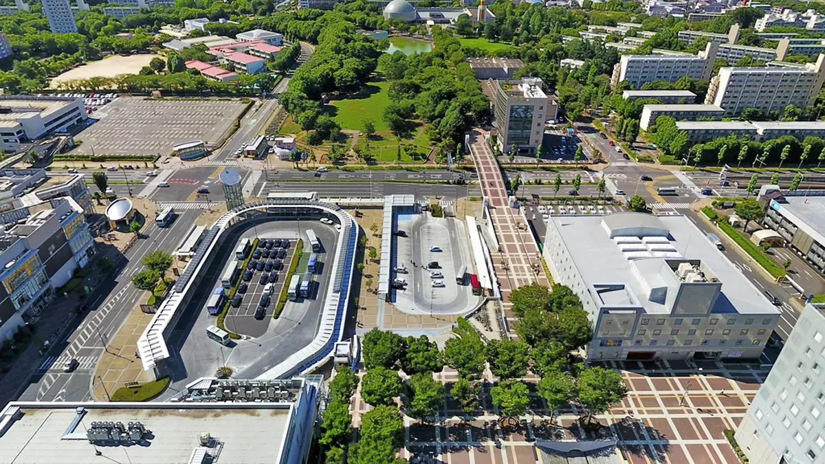
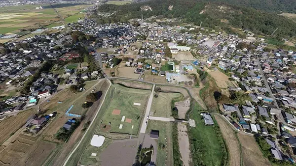
Tsukuba Center/Tsukuba Station Area: Tourist Starting Point

- (1) Starting Point for Sightseeing and Transportation
- Tsukuba Center Building is located in Azuma, Tsukuba City, and is a landmark facility of Tsukuba Science City. It integrates hotels, concert halls, commercial and business facilities. Additionally, Tsukuba Station of Tsukuba Express, a highway bus terminal, and local bus terminals are located nearby, making it the transportation hub of Tsukuba City.
- Location〒305-0031 1-10-1 Azuma, Tsukuba City, Ibaraki Prefecture
- (2) Starting Point for VR Tour
Sightseeing Starting Point for Tsukuba City VR Tour
The area around Tsukuba Center Building is the sightseeing starting point for the Tsukuba City VR tour, allowing you to move to aerial VR views of all sightseeing spots in Tsukuba City. Furthermore, you can move to sightseeing starting points in neighboring municipalities and from here to nearby recommended sightseeing spots out of the 16 recommended sightseeing spots in Ibaraki Prefecture.
- The image above is a VR aerial panorama photo taken at 148m above Tsukuba Center Building. The Tsukuba Center Building area VR tour consists of 148m aerial views, Tsukuba Station, the bus terminal, Tsukuba Center Building, and the pedestrian deck.
Tsukuba Expo Center: Science Exhibition and Experience Spot in Tsukuba City

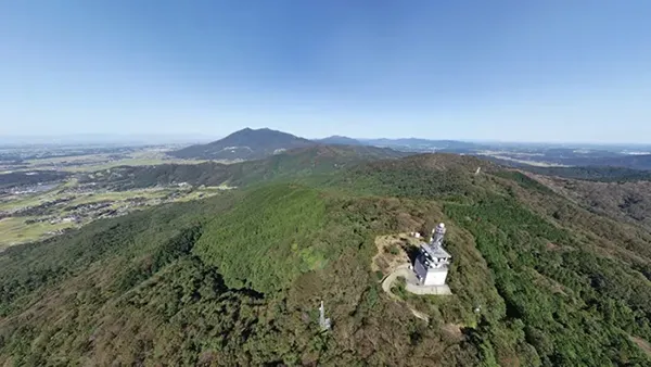
Mount Tsukuba: A Popular Spot for Sightseeing and Hiking
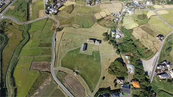
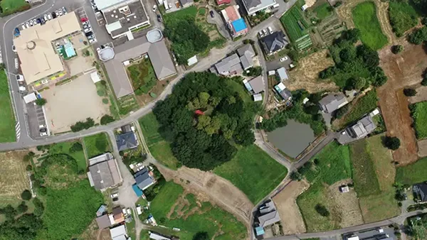
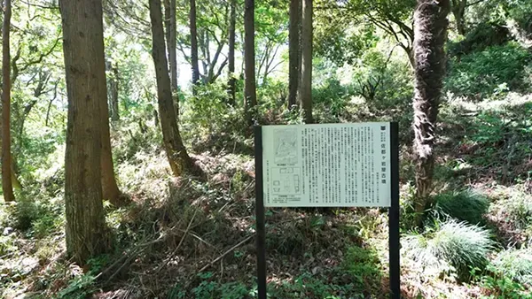
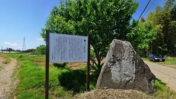
Oda Castle Ruins: A National Designated Sightseeing Spot in Tsukuba City

Explanation of Odajo Castle and Tourist VR Tour Guide
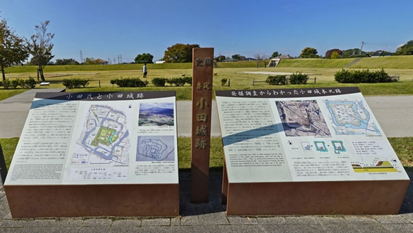
Hatta Tomoie, who fought alongside Minamoto no Yoritomo when Yoritomo destroyed the Taira clan and established the Kamakura shogunate, received the shugo (provincial constable) position of Hitachi Province for his achievements and built Odajo Castle, becoming the ancestor of the Oda clan.
Until then, the southern part of Hitachi Province was governed by the Hitachi Taira clan, who had overthrown Taira no Masakado, but the Oda clan eventually became the largest daimyo in southern Hitachi Province, subjugating the Hitachi Taira clan. During the Koji and Eiroku eras of the Sengoku period, the head of the Oda clan, Oda Ujiharu, repeatedly engaged in conflicts with the Satake clan, Tagaya clan, Makabe clan, Uesugi Kenshin of Echigo, and the Later Hojo clan of Odawara. However, he was defeated in the Battle of Tebaisaka against the Satake clan in Tensho 1 (1573), and Odajo Castle fell into the hands of the Satake clan.
After Genki 1 (1570), lords from the Satake lineage, such as Ota Sukemasa (grandson of Ota Dokan), took over the castle, and it was abandoned in Keicho 7 (1602) when the Satake clan was transferred to Akita.
The image is an aerial panoramic photo taken 148m above the islet of Odajo Castle. The Odajo Castle VR tour consists of aerial views from 148m and 50m, as well as earthworks, the main bailey, and an information board.
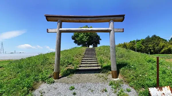
Hirasawa Kanga Remains: Tsukuba City Tourist Attraction / Nationally Designated

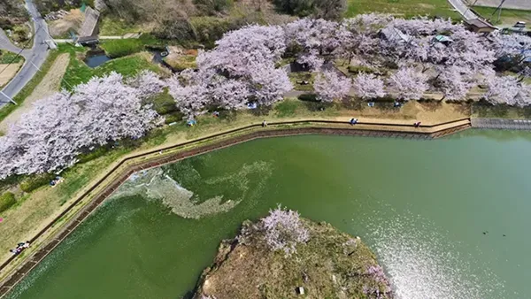
Oike Park (Hojo Oike Pond): Seasonal Tourist Spot in Tsukuba City

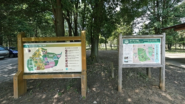
Mount Hōkyō: Hiking and Historic Site Tourist Spot in Tsukuba City

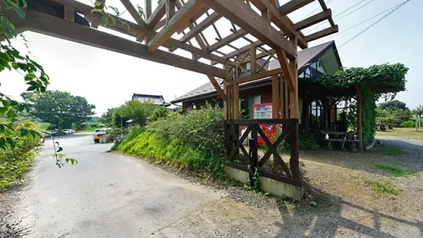
Mount Hōkyō Oda Rest Area: Hiking Spot
Stone Jizo Bodhisattva Statue: Historic Site & Recommended Autumn Leaves Spot
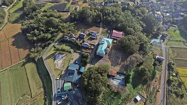
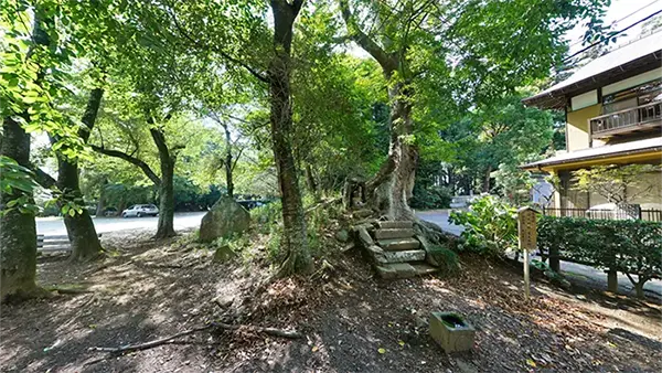
Gokurakuji Park: Nature & History Sightseeing Spot
Gokurakuji Temple and the High Priest Ninshō
Gokurakuji Park Gorinto (Five-Ring Pagoda): Hiking and Historic Site Spot
Tsukuba Kasumigaura Ring Ring Road: Cycling and Cherry Blossom Spot

Hiuchiga Pond: Mt. Tsukuba Landscape, Fishing, and Cluster Amaryllis Spot
Hiuchigai Pond's Great Hackberry Tree
Tsukuba Hakusui Lake: Recommended Spot for Scenery and Fishing
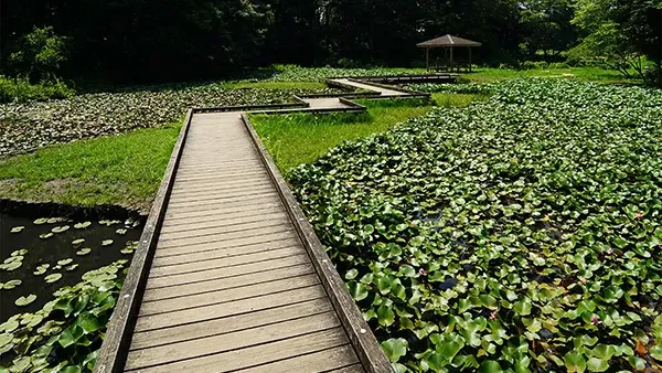
Ippai-kan Pond (Hanashitsu Pond): Cherry Blossoms, Water Lilies, and Fishing Spot
Takasaki Nature Forest: Nature Search & Experience Spot

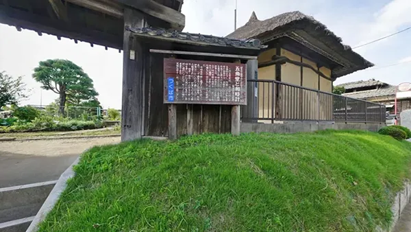
Gokakudo: Tsukuba City Historic Site Tourist Spot
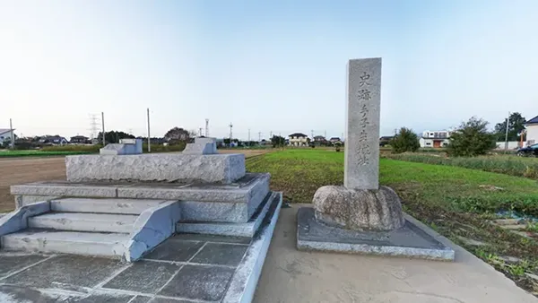
Mimori Castle Ruins: Recommended Historic Site Spot
Tegomaru Castle Ruins: Recommended Historic Site Spot
Numata Hachimanzuka Kofun: Historical Tourist Spot in Tsukuba City
Satsuga Iwaya Kofun: Recommended Historical Tourist Spot
Ichinoya Kofun Group: Recommended Historical Sightseeing Spot
Map of Ichinoya Kofun Group in Tsukuba City
Kurihara Atagozuka Kofun: Recommended Ruin Spot
Keicho Itabi (Stone Tablet): Recommended Historic Site
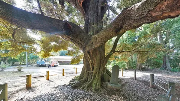
Sudajii Tree at Tsukuyomi Shrine: Giant Tree Spot
Enoki Tree at Kanamura Wake Ikazuchi Shrine: Giant Tree Spot
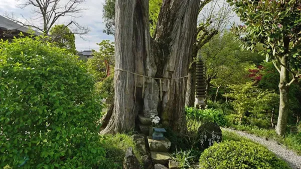
Fudo Kaya Tree at Ichijoin Shinfukuji Temple: Ancient Tree Spot
Kashima Shrine (Kurihara) Giant Zelkova Tree: Giant Tree Spot
Fukurai Bridge: Geography/Landscape Spot
Ota Bridge: Geography/Landscape Spot
Tadobe Weir: Geography/Landscape/Fishing Spot
TX Tsukuba Station: Geographical and Transportation Hub
Tsukuba Center Bus Terminal: Tsukuba City's Transportation Hub
Tsukuba Station Front Intersection: Geographical and Tourist Transportation Spot
Nishiodori Entrance Intersection: Geographical and Transportation Spot
Yatabe Interchange: Geography / Tourist Transportation Spot
Tsukuba-Chuo Interchange: Geography / Transportation Spot
Sakura-Tsuchiura Interchange: Geography / Transportation Spot

Tsukuba City's Neighboring Municipalities Tourist VR Tour Guide
Click on the municipality names below to navigate to VR tour guides for Tsukuba City's neighboring municipalities.
Tsukuba City Tourism VR Tour can be viewed on PCs and smartphones. You can experience 3D by using VR goggles.
The following are category pages independent from this tourism guide, differing from the above menu by season and location.