Mt. Tsukuba and Mt. Hōkyō Sunrise and First Sunrise Times and First Sunrise Spots
Mount Tsukuba Sunrise, Sunset, and Transit Time Search System
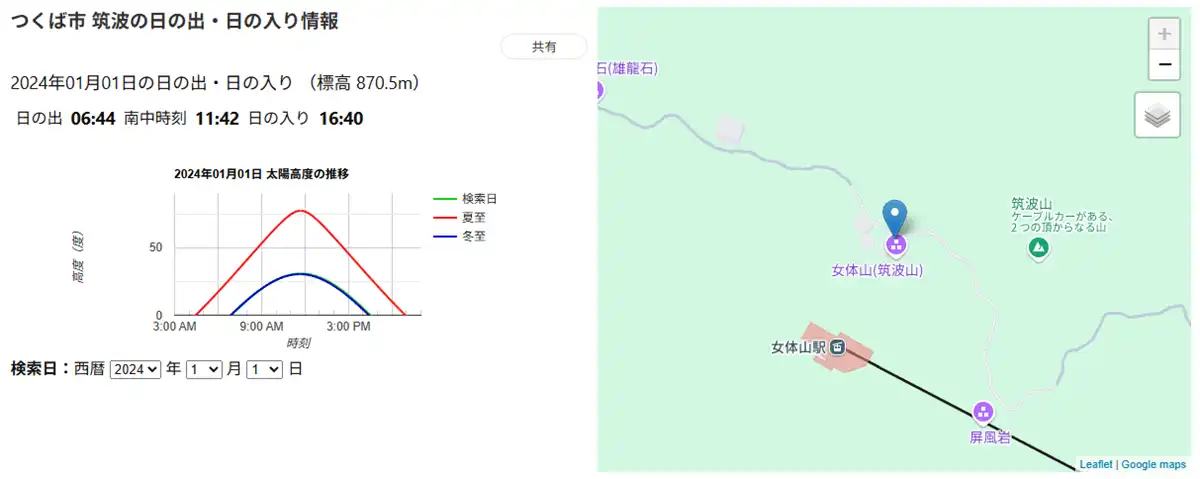
《Displaying Sunrise, Sunset, and Transit Times Based on Latitude, Longitude, and Altitude》
The sunrise, sunset, and transit altitude time search system displays the "Sunrise Time", "Sunset Time", "Transit Time", and "Altitude" for that location when you specify any point on the map within Tsukuba City and the target date. Clicking the search system image above will display the search screen.
The image above is an example showing Mount Nyotai summit of Mount Tsukuba, where Mount Nyotai's sunrise time on January 1st is 6:44.
Note that although calculated based on latitude, longitude, and altitude, it may be slightly delayed in inland or mountainous areas due to obstacles such as buildings and forests.
※The altitude displayed in the search system uses elevation data from the Geospatial Information Authority of Japan's GSI Maps. It may slightly differ from the triangulation point elevation shown on the map.
List of Recommended First Sunrise Spots on Mount Tsukuba
There are 8 sunrise spots in Tsukuba City, including Mount Hokyo in the Tsukuba mountain range. Some are not photos of the sunrise, but the approximate center of the photo indicates the sunrise position, a location where the first sunrise can be seen on the horizon. The sunrise on New Year's Day is at an angle of approximately 28 degrees from due east to southeast. You can confirm the sunrise position in a VR scene by clicking on the photo. Additionally, you can also view night view VR scenes from Mount Nantai summit, Koma Observatory night view, Mount Nyotai summit, and Observation Deck 298. You can find Tsukuba City's New Year's shrine visit and worship spots in the Tsukuba City Shrine Guide.
Click the thumbnail photos below to view explanations of the first sunrise, maps, and VR tours.
Mount Tsukuba / Mount Nyotai Summit First Sunrise
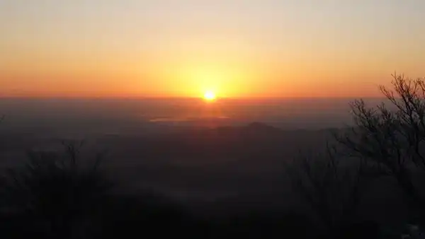
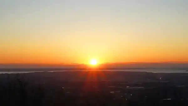
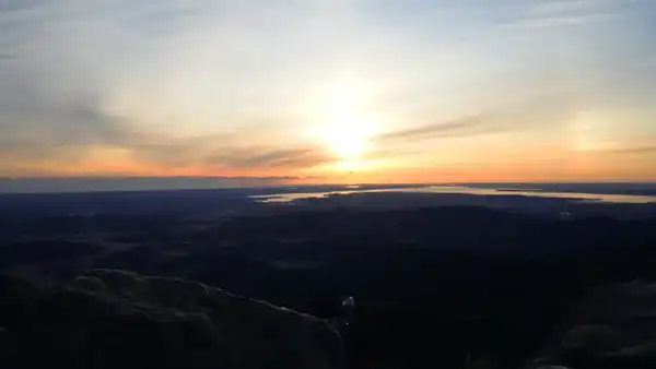 Mount Nyotai of Mount Tsukuba, altitude 877m, first sunrise time: 6:44
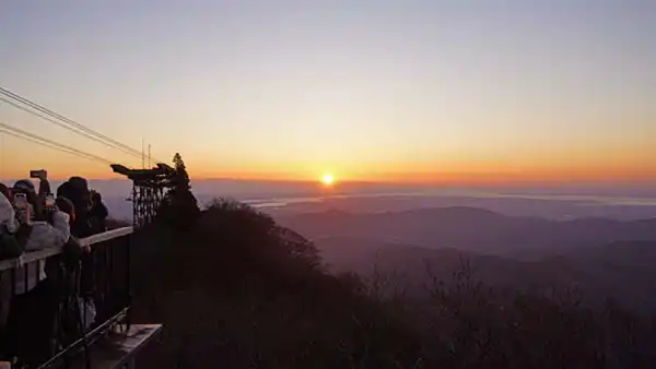
Mount Tsukuba Sky Deck First Sunrise
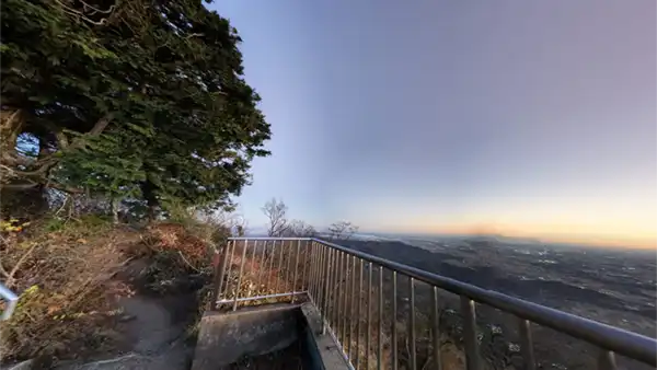
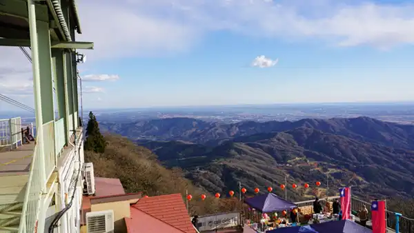
 Below Mount Nyotai of Mount Tsukuba, altitude 826m, Nyotai-san Station of the Ropeway
Mount Tsukuba Koma Observatory
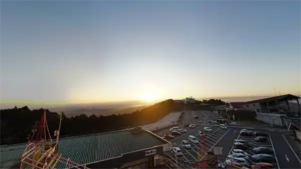
 Altitude 794m, Cable Car - Mt. Tsukuba Peak Station, Mt. Tsukuba Koma Observatory
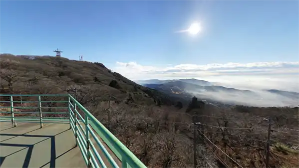
Mount Tsukuba / Mount Nantai Summit Area Hiking Trail
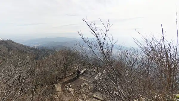 Hiking trail and rest area near Mount Nantai summit, around 860m altitude
Mount Tsukuba / Mount Nantai Main Shrine
 Mt. Tsukuba, Tsukuba Shrine,Elevation 871m,
First Sunrise at Mt. Tsukuba Tsutsujigaoka Plateau
 Mt. Tsukuba Otatsuishi hiking course, near elevation 675m
Tsutsujigaoka Parking Lot / Gama Daimyojin
 Elevation 641m, Tsutsujigaoka parking lot, Gama Land
First Sunrise at Tsukuba Mountains / Mt. Hōkyō
 Elevation 461m, hiking, Hōkyōintō
Mt. Tsukuba Annual Sunrise / First Sunrise Spot VR Tour Map
Summit of Mt. Nyotai: Famous Spot for First Sunrise at Mt. Tsukuba
Map of Mt. Tsukuba / Mt. Nyotai
First Sunrise from Sky deck 2983 (Sky Deck) at Mt. Tsukuba's Nyotai-san Station

Congestion Status of Sky Deck at Mt. Tsukuba Ropeway's Nyotai-san Station during the First Sunrise
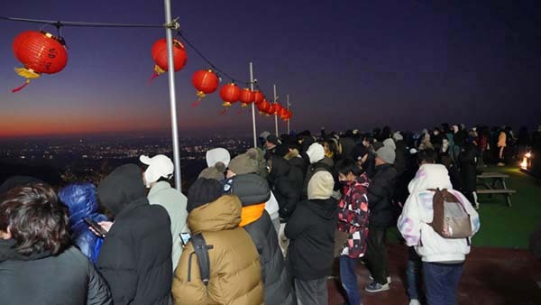
First Sunrise Observation Space on the West Side of Mt. Tsukuba Ropeway's Nyotai-san Station
Map of Sky deck 2983 (Sky Deck 2983)
Mount Tsukuba Koma Observation Deck: A famous spot for the first sunrise of the year on Mount Tsukuba
Map of the area around Mount Tsukuba Koma Observation Deck
Nantai-san Main Hall Observation Deck: A famous sunrise spot on Mount Tsukuba
Map of the area around Mount Tsukuba Nantai-san Main Hall
Hiking trail near the summit of Nantai-san: A famous sunrise spot on Mount Tsukuba
Map of the Area Around Mount Tsukuba Nantai
Tsutsujigaoka Plateau: Mount Tsukuba's First Sunrise Spot
Map of the Area Around Tsutsujigaoka Plateau
Gama Daimyojin: Mount Tsukuba's First Sunrise Spot
Map of the area around Mt. Tsukuba Gama Daimyojin
Hokyosan Summit: First Sunrise Spot in Tsukuba City
Mt. Tsukuba First Sunrise Time: 6:44
Mount Tsukuba Cable Car and Ropeway First Departure AM 4:30